top of page

family history writer
vermont genealogist
Search


William's Conway: A Story Map
"William's Conway, c. 1890" Ann D. Watson 2017 Watercolor crayon and pencil on paper 5 3/8 x 10 3/8 inches Buildings L to R: Burkeville...
Ann D. Watson
Sep 11, 20171 min read
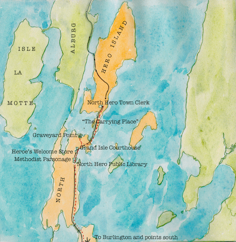
Mapping Monday: Research trip to North Hero
Here's a little map of a genealogical research trip I made to North Hero, Grand Isle County, Vermont. Creating maps is fun and can help...
Ann D. Watson
May 15, 20172 min read


William Watson, woolen mill worker
Today I honor my great-great-grandfather William Watson, who worked in the Burke/Delabarre woolen mill in Conway, Massachusetts, from...
Ann D. Watson
May 1, 20171 min read


Cumberland Island History and Genealogy
I recently visited Cumberland Island, the largest barrier island off the coast of Georgia. I don't pretend to know very much about this...
Ann D. Watson
Apr 2, 20173 min read


Genealogical Research Institute of Pittsburgh, Summer 2017
Really looking forward to Harold Henderson's June 2017 GRIP course on writing proof arguments, "From Confusion to Conclusion." See all...
Ann D. Watson
Mar 2, 20171 min read


Genealogy meets hand bookbinding
Being a hand bookbinder as well as a genealogist, I recently delighted in early Grand Isle County, Vermont court docket books. These...
Ann D. Watson
Feb 10, 20171 min read
bottom of page